What if the perfect Lakeway Estates lot is not just about the view, but about how the lake and the land actually work together? If you are scouting waterfront or hilltop-view property along Lake Travis, you are weighing lifestyle against technical details that matter on day one and 10 years from now. In this guide, you will learn how to compare lots by elevation, dock feasibility, utilities, watershed rules, and construction realities unique to Lakeway. You will also get a concise checklist and a practical timeline to move from interest to confident offer. Let’s dive in.
Lake Travis basics that shape your lot choice
Lake Travis is managed by the Lower Colorado River Authority (LCRA). LCRA sets lakewide rules for docks and marinas, shoreline safety standards, and many near-shore permits. Review the core rules on the LCRA Buoys, Docks and Marinas page for what is and is not allowed, from flotation to maximum distances.
The lake’s conservation pool sits at 681 feet mean sea level. That number matters because shoreline depth and dock usability change with lake level. Compare any lot’s elevations to this reference so you understand how access might shift between drought and wet years.
The takeaway is simple. Do not rely only on today’s waterline. Water-level variability affects ramp reach, dock anchoring, and whether your design can safely and legally project into navigable water. A little homework early protects your plan later.
Waterfront vs hilltop lots: what changes for you
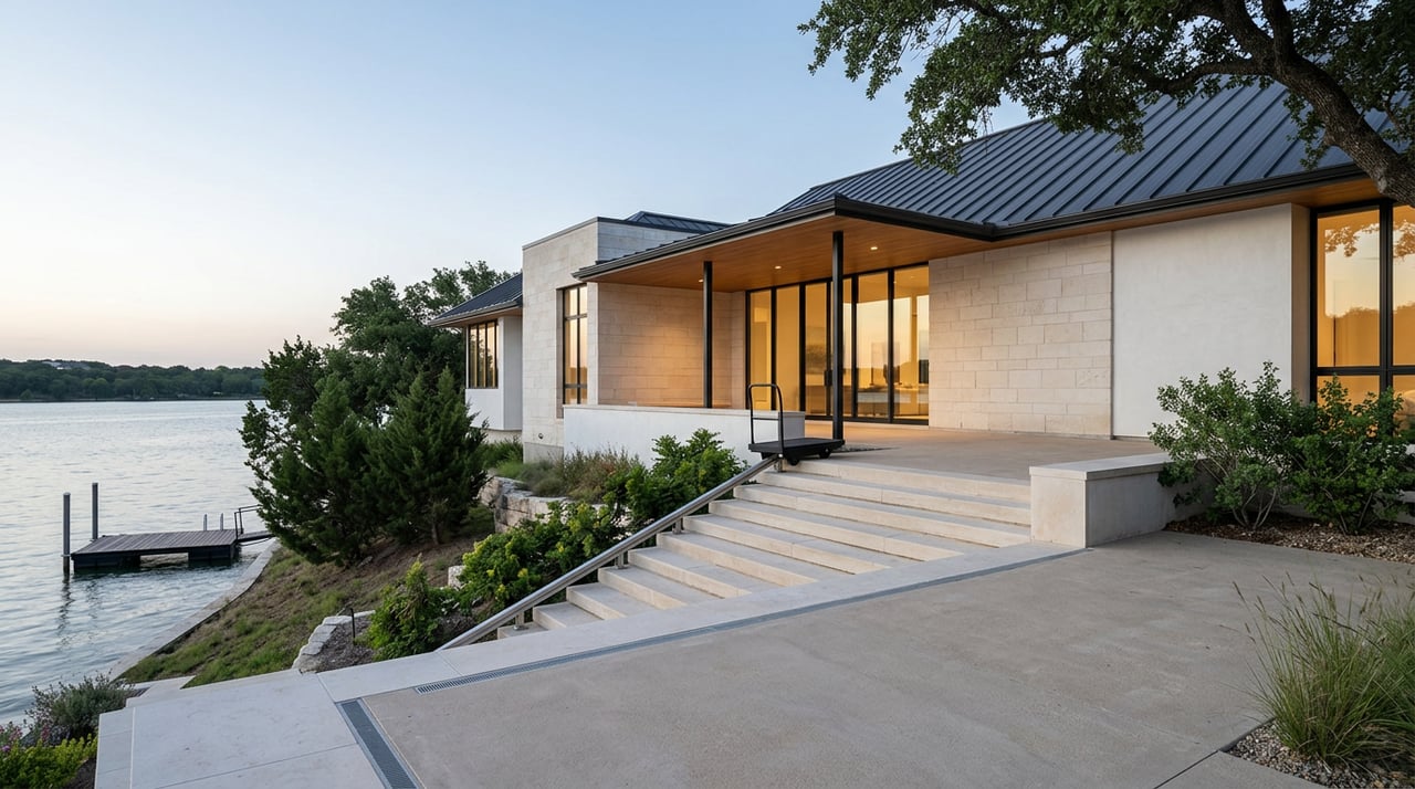
Waterfront: direct access with added rules
Waterfront parcels deliver the shortest path to the lake and, in many cases, the potential for a private residential dock under LCRA standards. You will weigh:
- Direct water access and potential for a permitted dock subject to LCRA and City of Lakeway requirements.
- Shoreline slope, depth, and cove width that influence where a dock can sit and how far it can extend.
- More intensive scrutiny for drainage, wastewater and construction near the shoreline.
- Finish-floor and shoreline elevations that must be tested against historical lake highs and lows.
Hilltop-view: stable siting and long vistas
Hilltop or view lots often sit higher and away from near-shore constraints. You will trade direct water access for privacy, long-range views, and typically lower flood exposure. Expect:
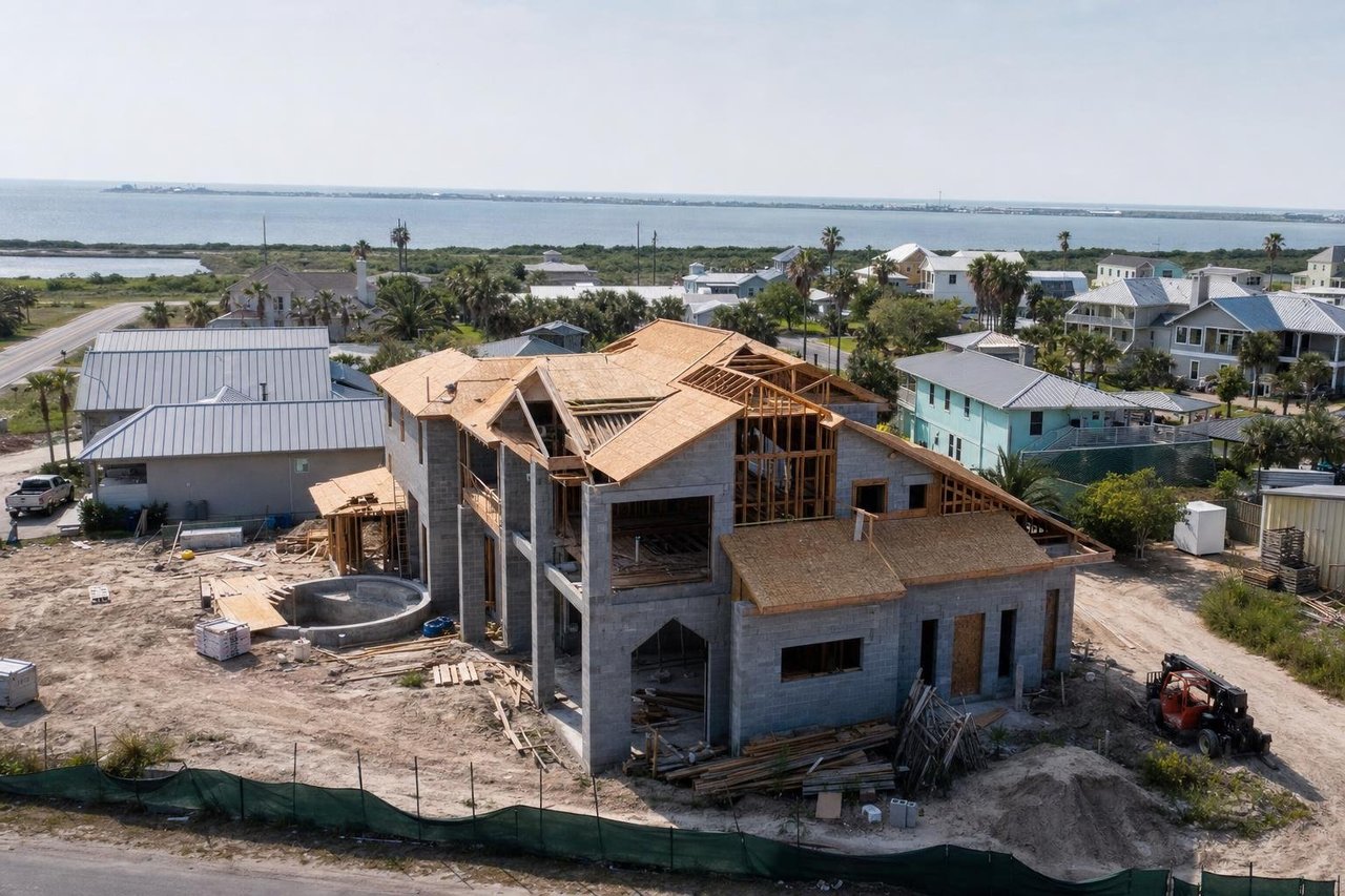
- Steeper grades that drive retaining walls, longer driveways, and more site prep.
- Excavation in limestone and thin soils common to the Lakeway escarpment, which can shape foundation choices.
- Options like a recessed path, long stairs, or an engineered hillside tram to reach the water where allowed.
Elevation, topography and dock viability
Elevations to request on any listing
Ask the listing agent or surveyor for three numbers: top-of-lot elevation, any home’s finished-floor elevation, and the elevation at the ordinary high-water mark or the plat’s reference contour. Compare them to the 681 feet mean sea level conservation pool. This lets you forecast seasonal dock position and walkway length before you commit.
Projection, cove rules and depth
LCRA limits how far a structure can extend into Lake Travis. Residential docks are generally limited to a maximum 100 feet of projection from the shore, and cove geometry can add restrictions. In coves narrower than 40 feet across when including opposing docks, projecting docks are often not allowed, and a recessed design may be the only option. These rules can make or break a specific dock concept, so verify early on the LCRA Buoys, Docks and Marinas page.
Bluffs and regulated slopes
Travis County and local codes define what counts as a bluff, and steep bluffs trigger special rules on how much disturbance is allowed and what kind of technical reports you need. Confirm whether your lot meets the county’s regulated conditions before planning cut-and-fill or shore-adjacent structures.
Boat access options: docks, ramps and hillside trams
Submerged land and permission to dock
LCRA allows private residential docks where the owner either owns the submerged land under the dock or has permission to use it. Do not assume rights. Confirm submerged-land ownership or recorded easements through title and LCRA Real Estate Services as described on the LCRA docks guidance.
City dock permits and safety standards
Inside Lakeway city limits, docks require a city permit for build, replacement, or repair. The code covers address visibility from the water, encased flotation for new docks, wiring, lighting, and operational allowances when lake levels are very low. Always align your plan with the City of Lakeway code and LCRA requirements.
Trams and inclined lifts down steep grades
Hillside trams are engineered systems commonly treated under elevator codes and require permits, stamped plans, and inspections. If a tram touches shoreline or crosses LCRA property, you will also coordinate with LCRA. Engage a vendor early to scope engineering, power, foundations, and inspection schedules consistent with industry guidance.
Utilities, wastewater and watershed rules
Sewer vs septic near Lake Travis
Within 2,000 feet of Lake Travis, LCRA administers the On-Site Sewage Facilities program. Some Lakeway properties connect to municipal or MUD sewer while older sections may use septic. Verify whether a parcel is on LMUD sewer or will require an OSSF by checking LCRA’s OSSF program details and confirming service through Lakeway Municipal Utility District.
Impervious cover and stormwater controls
Development within the watershed follows the LCRA Highland Lakes Watershed Ordinance and its technical manual. Expect design rules for impervious cover, BMPs like biofiltration or rainwater harvesting credits, construction-phase erosion control, and long-term maintenance obligations. These requirements shape driveway alignment, pool placement, and grading plans.
Electric and communications
Electric service for Lakeway varies by address between Austin Energy and Pedernales Electric Cooperative. The City of Lakeway FAQ is a good starting point, but always confirm the provider for the specific parcel. Coordinate with ISPs and your HOA or MUD on conduit or fiber plans when you review utilities.
Design and construction on steep sites
Geotechnical report and foundation choices
On hillside or bluff lots, a geotechnical report is standard practice and often required. The report defines soil and rock conditions, groundwater, bearing capacity, and recommendations for foundations, retaining walls, and slope stability. Expect solutions that range from shallow footings in competent rock to drilled piers, caissons, or micropiles.
Retaining walls and large grade transitions
Walls that retain significant grade changes generally require engineered design and city or county approval. The City of Lakeway code requires plans signed and sealed by an engineer or architect for masonry walls at or above specific heights. Budget for engineering, inspections, and quality construction to manage long-term stability.
Drainage, erosion and permanent BMPs
Hillside work near the lake must include erosion control and permanent stormwater measures set by the HLWO technical manual. Integrate BMPs into design early so that site drainage, cisterns, and landscape tie-ins are efficient and compliant.
Flood zones and insurance
Do not assume a high lot sits outside flood risk. Confirm the FEMA Flood Insurance Rate Map zone for the parcel through FEMA’s Flood Map Service Center. Lenders require flood insurance if a structure sits in a Special Flood Hazard Area, and an Elevation Certificate can clarify edge cases near mapped boundaries.
Due-diligence checklist for Lakeway Estates lots
Gather these items from the listing agent and seller, then verify with the city, county, LCRA, and title:
- Current survey and plat showing property lines, shoreline boundaries, and any statements about riparian or lakebed ownership; note easements to or across the lake. See LCRA’s dock guidance for submerged-land context.
- Title commitment noting any recorded dock permits, leases, or submerged-land easements; flag any LCRA easements or LCRA-owned shoreline.
- HOA or POA covenants for Lakeway Estates, including any restrictions on dock styles, colors, lighting, or shared facilities.
- Existing dock documentation: last permit or inspection, design drawings, photos at current lake level, and whether flotation is encapsulated; ask about any LCRA notices of violation.
- Utility availability: written confirmation from LMUD or other district on water and sewer; if septic, request OSSF records through LCRA; confirm the electric provider and any transformer or service-drop needs; ask the listing agent which ISPs serve the street.
- FEMA flood-zone map, any Letters of Map Change, and available surveyor elevation data for the lot and proposed building pad.
- Topographic site plan and any prior geotechnical report; if absent, plan for a new geotechnical investigation before you remove your option.
- Permitting path summary: City of Lakeway dock permit needs, LCRA status for any dock over 1,500 square feet or marina-like structures, and HLWO or Travis County coordination if new grading or permanent BMPs are planned.
Fast-track timeline if you are ready to move
- Week 1: Collect the survey, plat, title commitment, HOA rules, and any existing permits and dock photos. Screen for deal-breakers such as cove width or lack of submerged-land rights per LCRA rules.
- Weeks 2–3: Order a geotechnical report; confirm OSSF or sewer status with LCRA and LMUD; request a formal FEMA flood determination; verify electric provider and capacity; outline BMP requirements from the HLWO technical manual.
- Weeks 3–4: Meet with City of Lakeway planning and building staff and LCRA Water Surface Management to review your intended dock or tram concept and uncover projection, cove, or safety constraints before design proceeds.
How Seven Custom Homes supports your lot decision
You want a legacy home on Lake Travis without friction. Seven Custom Homes operates as a single accountable partner through lot evaluation, design coordination, permitting, selections, purchasing, and construction. Our team works these Lakeway-specific variables every day, from bluff setbacks and HLWO BMPs to dock alignment and hillside foundations, so your design ambition matches the realities of the site.
- Integrated design-build: one senior-led team stewarding decisions from day one.
- Regional expertise: hill-country limestone, steep grades, lakeside utilities, and waterfront permitting are core to our portfolio.
- Data-driven governance: our proprietary AI platform flags schedule and budget risk so you get fewer surprises and clearer choices.
Ready to evaluate a Lakeway Estates lot or shape a concept that fits both the land and the rules? Connect with David Lyne to start a focused custom home consultation.
FAQs
Does Lake Travis allow private residential docks in Lakeway?
- Yes, LCRA allows private residential docks where site conditions and ownership rights align, and the City of Lakeway also requires a dock permit; start with the LCRA Buoys, Docks and Marinas guidance and the City code for specifics.
What does the 681 feet mean sea level figure mean for my lot?
- LCRA defines Lake Travis’s conservation pool at 681 feet msl, so compare your lot’s elevations to that benchmark to predict dock reach, walkway length, and seasonal usability.
How far can a dock extend and what if my cove is narrow?
- On Lake Travis, LCRA generally limits docks to a maximum projection of 100 feet from shore and enforces cove-width rules where recessed docks may be required in narrow coves.
How do I confirm sewer vs septic for a Lakeway Estates parcel?
- Check LCRA’s OSSF program for septic jurisdiction near Lake Travis and contact Lakeway Municipal Utility District to confirm water and wastewater service for the specific address.
What permits apply if I want a hillside tram down to the water?
- Trams are engineered inclined-lift systems that need building permits, stamped plans, and inspections, and may require LCRA coordination if they interface with shoreline or submerged land; consult a vendor early.
Do I need a geotechnical report for a hilltop-view lot?
- Yes, a site-specific geotechnical report is standard and often required for steep or bluff lots because it drives foundation selection, slope stability measures, and retaining-wall design.
How do watershed rules affect driveways, pools, and patios?
- The HLWO technical manual sets impervious-cover limits and BMP requirements, which influence where and how you place hardscape and how you manage runoff long term.
How can I check flood risk before I write an offer?
- Use FEMA’s Flood Map Service Center to find the property’s FIRM zone, then consider an Elevation Certificate if the site is close to a mapped boundary to clarify insurance needs.